HAMPTON: A CENTURY OF TOWN AND BEACH, 1888-1988
Chapter 13 Photographs
Rural Village to Suburb
Population; Community Development; Comparison of Property Valuation, Budgets, Population, and Tax Rates for Selected Years
(Note: Page numbers are from Mr. Randall’s book.)
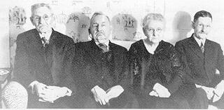
Page 468: Children of George A. and Hannah (Page) Blake: John Colby, George Bartlett, Sarah (Blake) Barbour, and Benjamin, all of whom lived into their late 80s or older, ca. late 1940s. Courtesy Jewell Brown.
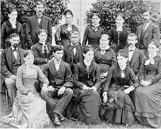
Page 468: Captain Jonathan and Theodate Godfrey and their children. Front row from left: Mary, Edward, Addie, Clara, and Rebecca. Middle row: Jacob, Elizabeth, Jonathan and Theodate, and Washington. Back row: Marcia, Warren, Maria, Lucy, Abby, and Oliver. Courtesy Gertrude Palmer.
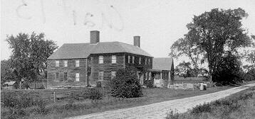
Page 470: One of Hampton’s older houses is the Knowles Homestead, 24 Locke Road. The Knowles family purchased the land in 1666 and built at least two houses on the property. The left section of the house is older than the right section, which was built by Amos Knowles and dates from ca. 1800. The property passed out of the Knowles family in 1905, and, in 1909 it was purchased and restored by summer resident John M. Brooks of Salem, Massachusetts. This view is ca. 1900. Courtesy MHGMHA.
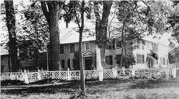
Page 470: The old Toppan Mansion, with its unique fence, was located on Lafayette Road, near the site of the Cinema Six Theatre [***]. According to family legend, the fence builder was instructed to make every section of the fence with a different pattern. As the workman neared what is the right end of the fence, he was out of ideas, but saw a spider web and made a section to match it. Unoccupied for some time, the house was torn down by owner Christopher Toppan in October 1901. Courtesy Wayne P. Bryer.
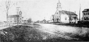
Page 473: Winnacunnet Road, before 1897, looking east. Courtesy Wayne P. Bryer
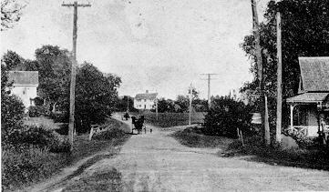
Page 474: Rural Hampton, about 1890. Park Avenue at junction with Landing Road. Courtesy Wayne P. Bryer.
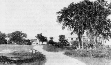
Page 474: Rural Hampton about 1890. Five Corners, looking up Little River Road from Locke Road. Courtesy Wayne P. Bryer.
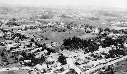
Page 476: Aerial view over Hampton Center, 1920s. Courtesy Madeline Nudd.
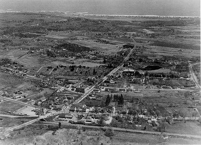
Page 478: Aerial view of Hampton, ca. 1940. Note only two houses on Moulton Road, the old Hampton Academy adjacent to the new building, and the pond behind the Academy. Within 15 years, much of the open land between High Street and Winnacunnet Road would be developed with houses. Courtesy Wayne P. Bryer.
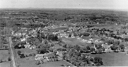
Page 479: Aerial view of Hampton looking north with the Toppan Farm in left foreground and Winnacunnet Road extending right, ca. 1950. Courtesy Jewell Brown.