HAMPTON: A CENTURY OF TOWN AND BEACH, 1888-1988
Chapter 3 Photographs
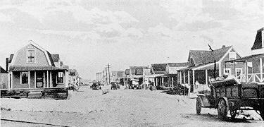
The Auto Era
Breakwaters, White Rocks Island,
and Hampton Beach State Park
1927-1949
(Note: Page numbers are from Mr. Randall’s book. Click on the page number to view the images.)
Page 168 : Early view of the Casino and the extensive, protective sand dune. When this was removed, the buildings lost their protection from ocean storms and a seawall had to be constructed. Courtesy Ansell Palmer.
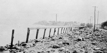
Page 168: Town breakwater along the main beach, south of Cutler’s, ca. 1914. Courtesy Janet Fitzgerald.
Page 170 : Artist’s rendering of Hampton Beach development as proposed in the Warren Manning Plan. Note airfield on the marsh behind the main beach, parks and a music shell in front of the Casino, a lighthouse at the edge of the river, and a road from the west ending adjacent to the Ashworth [Hotel]. Drawing by E. Hans.
Page 171 : Continuation of artist’s drawing of panorama of Hampton Beach development as outlined on page 170.
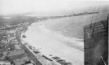
Page 172 : Aerial view of the main beach, ca. 1919. Sand dunes along the beach helped protect the buildings from storms, until the dunes were removed. [Photo was taken by David F. Colt, Sr. The pilot of the bi-plane could possibly be Earl Crabb, a WWI aerial photographer pilot who worked with Mr. Colt during WWI.] Courtesy Helen Worledge Hayden
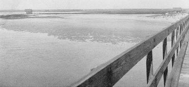
Page 175 : View of the west side of the Hampton end of the Mile Bridge, now the location of the State fishing pier and the Smith & Gilmore property. Courtesy Arthur Moody.
Page 175 : View of the east side of the end of the bridge, the section known as White Rocks Island, 1904. Great Boar’s Head is seen in the far background at the center of the photograph, a view taken as part of the Frank Beckman vs. the Town of Hampton case. Beckman’s house is out of view at the right end of this photograph. Courtesy Arthur Moody.
Page 176 : The mouth of Hampton River with Frank Beckman’s camp in the background. Courtesy Jewell Brown.
Page 176 : View from Beckman’s cottage, Rivermouth Rocks, toward White Rocks Island. Courtesy Myra Driscoll.
Page 179 : Hampton River inlet, 1855-1931. Map by Alex Wallach.
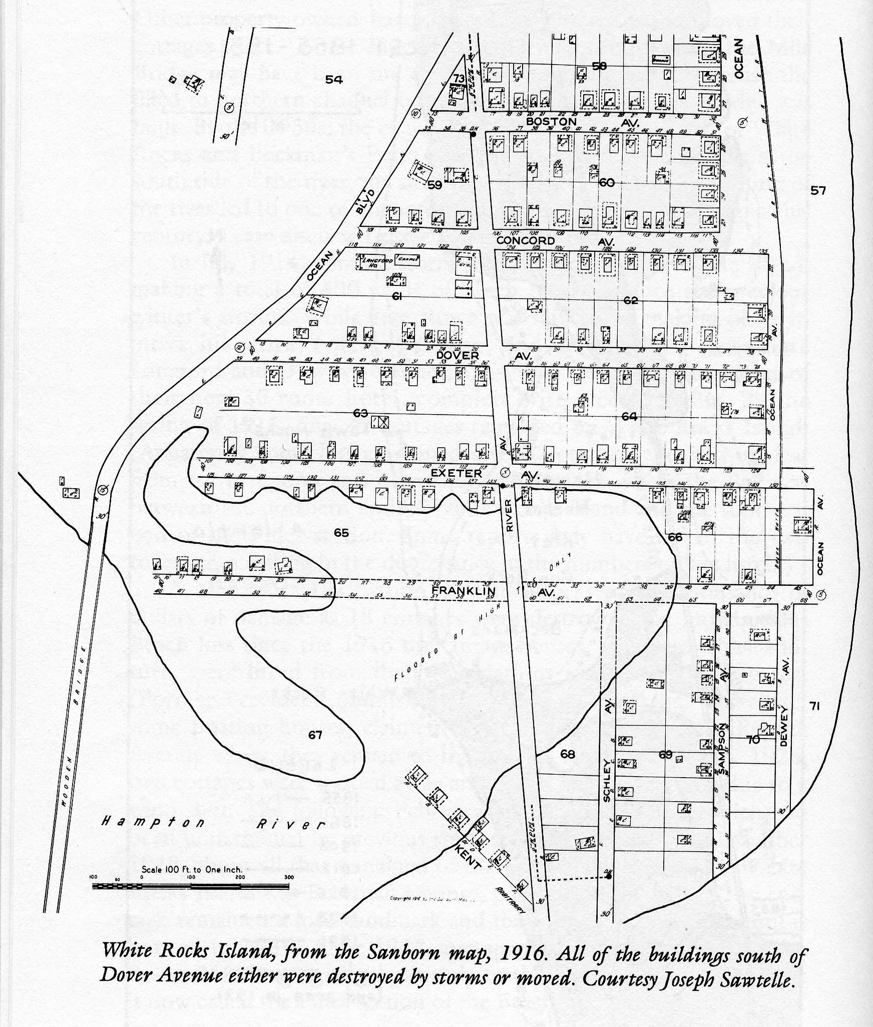
Page 180 : White Rocks Island, from the Sanborn map, 1916. All of the buildings south of Dover Avenue either were destroyed by storms or moved. Courtesy Joseph Sawtelle.
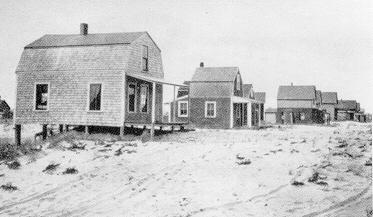
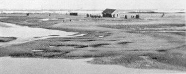
Page 183 : Dewey Avenue, White Rocks Island, one of the streets eventually destroyed by storms and erosion. Courtesy Jewell Brown.
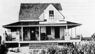
Page 183 : Jere Rowe’s store, White Rocks Island. Courtesy Janet Fitzgerald.
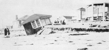
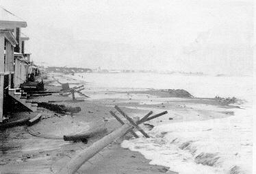
Page 184 : House in the Pines section of the main beach falling in the ocean, and the inadequate breakwater, March 1931. *** Courtesy Ansell Palmer.
Page 184 : [Robert] Ring family’s popcorn building after storm, ca. 1930. Ada P. Carlson photograph. Courtesy Donald Ring.
Page 184 : The main beach flooded, Ocean Boulevard, 1928. Courtesy Charlotte E. Ricker.
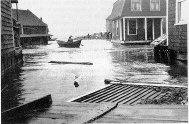
Page 185 : Flooded houses, White Rocks Island, 1920s. Courtesy Alzena Elliot.
Page 185 : Storm damage, White Rocks Island, March 1931. Courtesy Ansell Palmer.
Page 187 : Last house being moved from White Rocks Island by teams of oxen. Courtesy Richard Perkins.
Page 187 : Dover Avenue, Hampton Beach south. Third house on right was moved by George and Alfred “Tacky” Gauron by horse to site from White Rocks Island. Courtesy Beatrice Perkins.
Page 188 : Storm damage and the remains of the town breakwater, north of Great Boar’s Head. Courtesy Lorraine King Brown.
Page 188 : Storm damage along Ocean Boulevard, North Beach, 1930s. It was such destruction that finally convinced residents to deed over the beachfront to the State in return for a new breakwater. Courtesy MHGMHA.
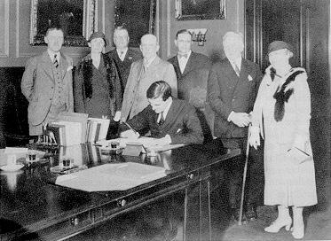
Page 191 : Governor John G. Winant signing the bill for Hampton Beach improvements for $510,000 to stabilize Hampton River and build the North Beach breakwater. Standing, left to right, ?, Mrs. Margaret Wingate, Ned Batchelder, Frank Emerson, James Tucker, Sr., George Ashworth, and Mrs. Fred Batchelder. June 17, 1933. Courtesy MHGMHA.
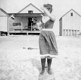
Page 193 : Mary Toppan, dressed for a swim, likely at North Beach bathhouses. Mary was a pioneering amateur photographer and many older Hampton photographs were taken by her. Courtesy Wilma Toppan White.
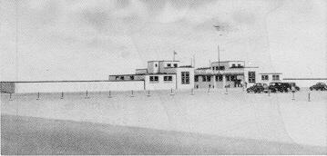
Page 193 : The state bathhouse, built 1938. Courtesy Janet Fitzgerald.
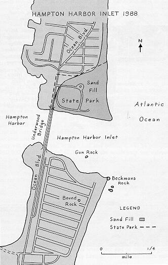
Page 194 : Hampton River inlet, 1988. Map by Alex Wallach.
Social Events, Swimsuits, and Rudy Vallee
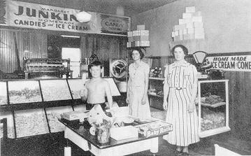
Page 197 : Margaret Junkins, at right, in her first Hampton Beach candy shop. Her son Seth, age 13, is at left. Mrs. Junkins, who had been a nurse, and here husband Ernest, started a candy business in Lawrence, Massachusetts, in 1920 and moved to Hampton Beach about 1930. Ernest died in 1934, leaving his wife to run the candy shop alone for nearly 50 years until she retired in 1983. The candy shop is now operated by her granddaughters. Courtesy Starr Perry.
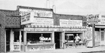
Page 197 : Junkins’ Candy Shop, Hampton Beach. Courtesy Jewell Brown.
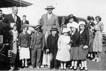
Page 198 : Rudy Vallee, center, at Hampton Beach with the Little People. Courtesy Alzena Elliot.
Page 198 : The Dance Carnival , Boar’s Head. Courtesy Gertrude Palmer.
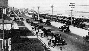
Page 201 : Ocean Boulevard, late 1920s. Courtesy Edwin L. Batchelder, Jr.
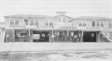
Page 201 : Byron’s Garage, Ashworth Avenue, circa 1930, now part of the Sea Gate Motel. Courtesy Stanwood Brown.
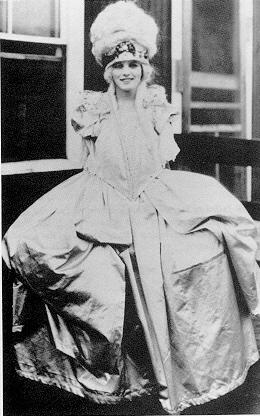
Page 203 : Mildred Dudley (Autio), Miss Hampton Beach contestant. Courtesy Beverly Ring Prakop and Lloyd C. Ring, Jr.
Page 204 : When the Town failed to keep the beachfront clean, Precinct officials, business people, and vacationers alike grabbed rakes to do the job, 1930s. Courtesy MHGMHA.
Page 204 : The bandstand, complete with speakers and the remodeled Casino, 1936. Courtesy Jewell Brown.
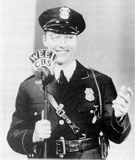
Page 206 : Bill Elliot, the “Singing Cop”. Courtesy Alzena Elliot.
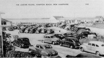
Page 208 : The original Hampton River Yacht Club later became the Smith and Gilmore fishing company and lobster pound, Hampton River. Courtesy Jewell Brown.
Page 208 : View north from second floor of the Chamber of Commerce building showing the playground, with the raffle car in the foreground, 1930. Courtesy Jewell Brown.
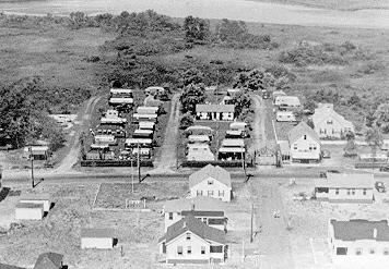
Page 209 : Leavitt’s Camps, North Beach, 1930s. Courtesy Jewell Brown.
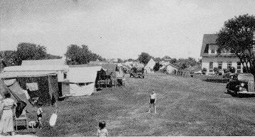
Page 209 : Dan Mahoney’s Trailer Park, King’s Highway, August 1938. Rates were $2 per day for two people, $12 per week, or $100 for the season, $125 with sewerage. Courtesy Charlotte E. Ricker.
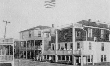
Page 210 : The Avon, right, and the Wigwam, B Street. Ashworth’s original Avon, expanded several times into a much larger hotel, was torn down in 1989. Courtesy Jewell Brown.
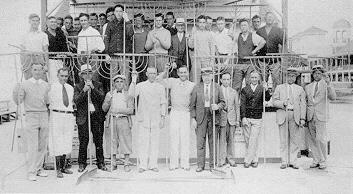
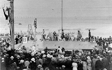
Page 210 : Vaudeville by the sea. Courtesy Gertrude Palmer.
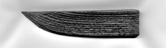
Page 212 : “On July 23, 1940, an airplane crash took the life of a young army pilot on the marsh just west of the Beach and north of Boar’s Head. Lost in the fog, Second Lieutenant Raoul Burgoin was killed instantly when the plane hit power lines and bounced off a small cottage. [From Peter E. Randall’s “HAMPTON, A Century of Town and Beach, 1888-1988”] This is a piece of the roof of the cottage that the plane hit on July 23, 1940. [Courtesy of John & Connie Holman, Hampton, NH, 2003]
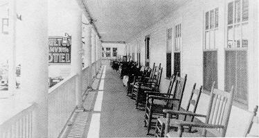
Page 213 : Moulton Janvrin Hotel, second-floor porch, from a promotional brochure. Courtesy Myra Driscoll.
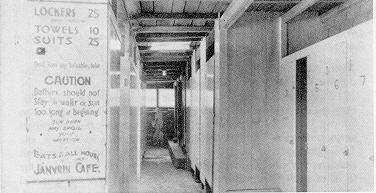
Page 213 : Moulton Janvrin Hotel’s bathhouse. Lockers 25 cents; Towels 10 cents, Suits 25 cents. Courtesy Myra Driscoll.
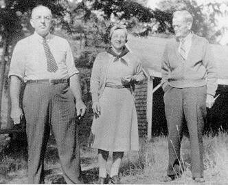
Page 214 : Left to right: Kenneth Ross, Elvena Ross, and Dan Mahoney. Courtesy Charlotte E. Ricker.
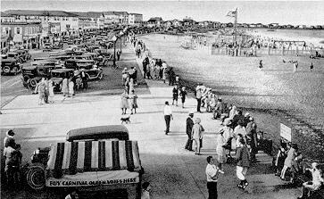
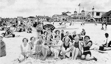
Page 217 : On the beach near the Casino, 1937. Courtesy Janet Fitzgerald.