Click map to enlarge
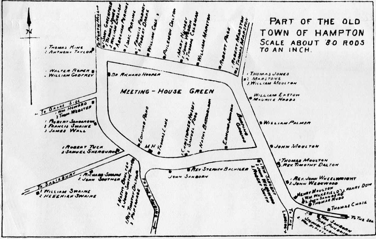
- The main road going horizontally across the top of the map then, at right, angling down to the right corner, is today's Winnacunnet Road. At the bottom right corner it leads "To The Sea".
- Today's Lafayette Road/Route One starts in the top left and goes vertically down (south) into the thicker road, then about 2/3 of the way down angles sharply off to the left corner in the small road reading "To Salisbury". That road today is pretty much straight as an arrow north to south.
- Midway down that same road a small road angles off to the left that reads "To Drake Side". That is today's Drakeside Road.
- The fat road leading from the point where Route One angles off "To Salisbury" to the right and its meeting with Winnacunnet Road, is today's Park Ave.
- The two roads leading off the bottom of the map both say "To the Landing", and at the time were both ends of a single road that went in a loop. Today they are still there, called Landing Road, but are cut off in the middle by a new highway.
- Lastly the small road in the top right is Mill Road.